
Conte aos seus amigos sobre este item:
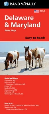
Rand McNally Easy to Read: Delaware, Maryland State Map
Rand Mcnally
Item sob encomenda (no estoque do fornecedor)
O que dizem nossos clientes:

Rand McNally Easy to Read: Delaware, Maryland State Map
Rand Mcnally
Rand McNally's folded map for Delaware and Maryland is a must-have for anyone traveling in or through these states, offering unbeatable accuracy and reliability at a great price. Our trusted cartography shows all Interstate, U. S., state, and county highways and much more. - Points of interest. - State Park chart. - State mileage chart. - Driving times map. - On-the-road toolbox. - Visitor center information. - Climate data. - State facts & symbols. - Easy-to-use legend. Coverage Area Detailed maps include: Dover, DE; Wilmington, DE; Annapolis, MD; Baltimore, MD; Baltimore Downtown, MD; Frederick, MD; Hagerstown, MD; Washington, D. C., Washington, D. C. Downtown. Product Details: Measures 9.0 x 4.125 and folds out to 25.5 x 36.75.
show more
| Mídia | Livros Paperback Book (Livro de capa flexível e brochura) |
| Lançado | 16 de maio de 2022 |
| ISBN13 | 9780528025686 |
| Editoras | RAND MCNALLY |
| Dimensões | 250 g (Peso (estimado)) |
| Idioma | English |
Mais por Rand Mcnally


Outros também compraram
![Cover for Preben Hansen · Turen Går Til: Turen går til Californien & Vestlige USA (Sewn Spine Book) [5th edição] (2021)](https://imusic.b-cdn.net/images/item/original/578/9788740063578.jpg?preben-hansen-2021-turen-gaar-til-turen-gaar-til-californien-vestlige-usa-sewn-spine-book&class=scaled&v=1623395637)
![Cover for Lise Nørgaard · Maxi-paperback: De sendte en dame (Paperback Book) [5th edição] (2017)](https://imusic.b-cdn.net/images/item/original/848/9788702234848.jpg?lise-noergaard-2017-maxi-paperback-de-sendte-en-dame-paperback-book&class=scaled&v=1494312137)
![Cover for Hanne Hostrup · Kæreste-billeder (Bound Book) [3th edição] [Indbundet] (1999)](https://imusic.b-cdn.net/images/item/original/927/9788741226927.jpg?hanne-hostrup-1999-kaereste-billeder-bound-book&class=scaled&v=1378850409)
![Cover for Sean Wilentz · Bob Dylan i Amerika (Sewn Spine Book) [1th edição] [Indbundet] (2013)](https://imusic.b-cdn.net/images/item/original/196/9788779559196.jpg?sean-wilentz-2013-bob-dylan-i-amerika-sewn-spine-book&class=scaled&v=1397632877)

![Cover for Rupert Sheldrake · The Science Delusion: Freeing the Spirit of Enquiry (Paperback Book) [New edition] (2020)](https://imusic.b-cdn.net/images/item/original/224/9781529393224.jpg?rupert-sheldrake-2020-the-science-delusion-freeing-the-spirit-of-enquiry-paperback-book&class=scaled&v=1602448404)


![Cover for Disney · Carl Barks & Don Rosa Bind III (Hardcover Book) [1th edição] (2021)](https://imusic.b-cdn.net/images/item/original/515/9788793840515.jpg?disney-2021-carl-barks-don-rosa-bind-iii-hardcover-book&class=scaled&v=1613510332)
Ver tudo de Rand Mcnally ( por exemplo Paperback Book , Map , Hardcover Book , Book e Spiral Book )