

Conte aos seus amigos sobre este item:
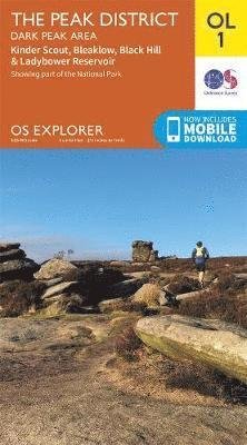
Correen Hills & Glenlivet, Bennachie & Ladder Hills, Insch & Rhynie - OS Explorer Map May 2015 edition
Ordnance Survey
Preço
A$ 24,99
excluindo impostos
Item sob encomenda (no estoque do fornecedor)
Espera-se estar pronto para envio 1 - 6 de ago
O que dizem nossos clientes:


Adicione à sua lista de desejos do iMusic
Correen Hills & Glenlivet, Bennachie & Ladder Hills, Insch & Rhynie - OS Explorer Map May 2015 edition
Ordnance Survey
OS Explorer is the Ordnance Survey's most detailed map and is recommended for anyone enjoying outdoor activities like walking, horse riding and off-road cycling. Providing complete GB coverage the series details essential information such as youth hostels, pubs and visitor information as well as rights of way, permissive paths and bridleways.
| Mídia | Livros Map (Mapas terrestres ou náuticos) |
| Lançado | 10 de junho de 2015 |
| ISBN13 | 9780319243015 |
| Editoras | Ordnance Survey |
| Dimensões | 142 × 221 × 11 mm · 108 g |
Mostrar tudo
Mais por Ordnance Survey


![Cover for Ordnance Survey · Barnard Castle & Richmond - OS Landranger Map (Map) [February 2017 edition] (2017)](https://imusic.b-cdn.net/images/item/original/396/9780319263396.jpg?ordnance-survey-2017-barnard-castle-richmond-os-landranger-map-map&class=scaled&v=1494082597)
![Cover for Ordnance Survey · Barnard Castle & Richmond - OS Landranger Active Map (Map) [February 2017 edition] (2017)](https://imusic.b-cdn.net/images/item/original/416/9780319475416.jpg?ordnance-survey-2017-barnard-castle-richmond-os-landranger-active-map-map&class=scaled&v=1509633955)
![Cover for Ordnance Survey · Kendal & Morecambe - OS Landranger Map (Map) [December 2016 edition] (2017)](https://imusic.b-cdn.net/images/item/original/402/9780319263402.jpg?ordnance-survey-2017-kendal-morecambe-os-landranger-map-map&class=scaled&v=1502268459)
![Cover for Ordnance Survey · Kendal & Morecambe - OS Landranger Active Map (Map) [December 2016 edition] (2017)](https://imusic.b-cdn.net/images/item/original/423/9780319475423.jpg?ordnance-survey-2017-kendal-morecambe-os-landranger-active-map-map&class=scaled&v=1510328767)
![Cover for Ordnance Survey · Penrith & Keswick - OS Landranger Map (Map) [December 2016 edition] (2017)](https://imusic.b-cdn.net/images/item/original/372/9780319263372.jpg?ordnance-survey-2017-penrith-keswick-os-landranger-map-map&class=scaled&v=1501480948)
![Cover for Ordnance Survey · Penrith & Keswick - OS Landranger Active Map (Map) [December 2016 edition] (2017)](https://imusic.b-cdn.net/images/item/original/393/9780319475393.jpg?ordnance-survey-2017-penrith-keswick-os-landranger-active-map-map&class=scaled&v=1501480948)
![Cover for Ordnance Survey · Appleby-In-Westmorland - OS Landranger Active Map (Map) [December 2016 edition] (2017)](https://imusic.b-cdn.net/images/item/original/409/9780319475409.jpg?ordnance-survey-2017-appleby-in-westmorland-os-landranger-active-map-map&class=scaled&v=1501480948)
![Cover for Ordnance Survey · Appleby-In-Westmorland - OS Landranger Map (Map) [December 2016 edition] (2016)](https://imusic.b-cdn.net/images/item/original/389/9780319263389.jpg?ordnance-survey-2016-appleby-in-westmorland-os-landranger-map-map&class=scaled&v=1485780746)
![Cover for Ordnance Survey · Howgill Fells - OS Explorer Active Map (Map) [October 2016 edition] (2016)](https://imusic.b-cdn.net/images/item/original/362/9780319475362.jpg?ordnance-survey-2016-howgill-fells-os-explorer-active-map-map&class=scaled&v=1485780746)
![Cover for Ordnance Survey · Wensleydale & Upper Wharfedale - OS Landranger Map (Map) [December 2016 edition] (2016)](https://imusic.b-cdn.net/images/item/original/419/9780319263419.jpg?ordnance-survey-2016-wensleydale-upper-wharfedale-os-landranger-map-map&class=scaled&v=1485780746)
![Cover for Ordnance Survey · Wensleydale & Upper Wharfedale - OS Landranger Active Map (Map) [December 2016 edition] (2016)](https://imusic.b-cdn.net/images/item/original/430/9780319475430.jpg?ordnance-survey-2016-wensleydale-upper-wharfedale-os-landranger-active-map-map&class=scaled&v=1485780746)
![Cover for Ordnance Survey · Howgill Fells - OS Explorer Map (Map) [October 2016 edition] (2016)](https://imusic.b-cdn.net/images/item/original/341/9780319263341.jpg?ordnance-survey-2016-howgill-fells-os-explorer-map-map&class=scaled&v=1485780746)
![Cover for Ordnance Survey · Yorkshire Dales Northern & Central - OS Explorer Map (Map) [August 2016 edition] (2016)](https://imusic.b-cdn.net/images/item/original/358/9780319263358.jpg?ordnance-survey-2016-yorkshire-dales-northern-central-os-explorer-map-map&class=scaled&v=1480751268)
![Cover for Ordnance Survey · Yorkshire Dales Northern & Central - OS Explorer Active Map (Map) [August 2016 edition] (2016)](https://imusic.b-cdn.net/images/item/original/379/9780319475379.jpg?ordnance-survey-2016-yorkshire-dales-northern-central-os-explorer-active-map-map&class=scaled&v=1480751268)
![Cover for Ordnance Survey · Yorkshire Dales South & Western - OS Explorer Map (Map) [August 2016 edition] (2016)](https://imusic.b-cdn.net/images/item/original/310/9780319263310.jpg?ordnance-survey-2016-yorkshire-dales-south-western-os-explorer-map-map&class=scaled&v=1551882372)
![Cover for Ordnance Survey · Yorkshire Dales South & Western - OS Explorer Active Map (Map) [August 2016 edition] (2016)](https://imusic.b-cdn.net/images/item/original/331/9780319475331.jpg?ordnance-survey-2016-yorkshire-dales-south-western-os-explorer-active-map-map&class=scaled&v=1480751268)
![Cover for Ordnance Survey · North Scotland - OS Admin Boundary Map (Map) [February 2016 edition] (2016)](https://imusic.b-cdn.net/images/item/original/408/9780319089408.jpg?ordnance-survey-2016-north-scotland-os-admin-boundary-map-map&class=scaled&v=1632046696)
![Cover for Ordnance Survey · Braemar & Blair Atholl - OS Landranger Active Map (Map) [February 2016 edition] (2016)](https://imusic.b-cdn.net/images/item/original/665/9780319473665.jpg?ordnance-survey-2016-braemar-blair-atholl-os-landranger-active-map-map&class=scaled&v=1480751522)
![Cover for Ordnance Survey · Mansfield & Worksop, Sherwood Forest - OS Landranger Active Map (Map) [February 2016 edition] (2016)](https://imusic.b-cdn.net/images/item/original/433/9780319474433.jpg?ordnance-survey-2016-mansfield-worksop-sherwood-forest-os-landranger-active-map-map&class=scaled&v=1466080057)
Outros também compraram
![Cover for Shahrnush Parsipur · Gyldendal Skala: Kvinder uden mænd (Bound Book) [1th edição] (2019)](https://imusic.b-cdn.net/images/item/original/745/9788702274745.jpg?shahrnush-parsipur-2019-gyldendal-skala-kvinder-uden-maend-bound-book&class=scaled&v=1544743050)
![Cover for Simone de Beauvoir · Gyldendal Skala: De uadskillelige (Bound Book) [1th edição] (2020)](https://imusic.b-cdn.net/images/item/original/057/9788702306057.jpg?simone-de-beauvoir-2020-gyldendal-skala-de-uadskillelige-bound-book&class=scaled&v=1601474807)
![Cover for Henrik Stub Helle Stub · Det levende Univers (Paperback Book) [4th edição] (2020)](https://imusic.b-cdn.net/images/item/original/391/9788757134391.jpg?henrik-stub-helle-stub-2020-det-levende-univers-paperback-book&class=scaled&v=1597686751)
![Cover for Gilles Deleuze og Félix Guattari · Gaia: Tusind plateauer (Sewn Spine Book) [1th edição] (2025)](https://imusic.b-cdn.net/images/item/original/421/9788779451421.jpg?gilles-deleuze-og-felix-guattari-2025-gaia-tusind-plateauer-sewn-spine-book&class=scaled&v=1742483039)
![Cover for Mikhail Sjisjkin · Brevbogen (Bound Book) [1th edição] [Indbundet] (2013)](https://imusic.b-cdn.net/images/item/original/482/9788792439482.jpg?mikhail-sjisjkin-2013-brevbogen-bound-book&class=scaled&v=1395788417)
![Cover for Rebecca Solnit · Orwells roser (Sewn Spine Book) [1th edição] (2024)](https://imusic.b-cdn.net/images/item/original/563/9788794024563.jpg?rebecca-solnit-2024-orwells-roser-sewn-spine-book&class=scaled&v=1713205459)
![Cover for Kirsten Thorup · Indtil vanvid, indtil døden (Sewn Spine Book) [1th edição] (2020)](https://imusic.b-cdn.net/images/item/original/624/9788702270624.jpg?kirsten-thorup-2020-indtil-vanvid-indtil-doeden-sewn-spine-book&class=scaled&v=1576660323)


![Cover for Russell Martin · Beethoven's Hair: An Extraordinary Historical Odyssey and a Scientific Mystery Solved (Paperback Book) [First Printing edition] (2001)](https://imusic.b-cdn.net/images/item/original/516/9780767903516.jpg?russell-martin-2001-beethoven-s-hair-an-extraordinary-historical-odyssey-and-a-scientific-mystery-solved-paperback-book&class=scaled&v=1417118532)
![Cover for Virginia Woolf · Feministisk bibliotek: Tre Guineas (Hardcover Book) [1th edição] (2023)](https://imusic.b-cdn.net/images/item/original/102/9788794504102.jpg?virginia-woolf-2023-feministisk-bibliotek-tre-guineas-hardcover-book&class=scaled&v=1695649236)
Mais dessa série
![Cover for Ordnance Survey · Correen Hills & Glenlivet, Bennachie & Ladder Hills, Insch & Rhynie - OS Explorer Map Active (Map) [May 2015 edition] (2015)](https://imusic.b-cdn.net/images/item/original/804/9780319469804.jpg?ordnance-survey-2015-correen-hills-glenlivet-bennachie-ladder-hills-insch-rhynie-os-explorer-map-active-map&class=scaled&v=1552770485)
Ver tudo de Ordnance Survey ( por exemplo Map , Paperback Book , Book e Hardcover Book )